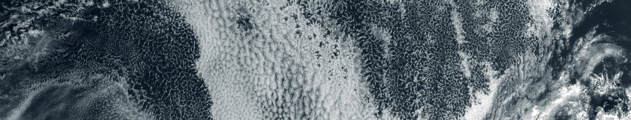
Marine stratocumulus and overlying clouds west of Baja California, here seen in Worldview using MODIS channels 3-6-7.
To the NW, and west of California, in this MODIS image, it looks like compensating subsidence from the NW-SE precipitating feature is quite dramatic. Impact on region albedo? I don’t think these systems can be perturbed by anthropogenic aerosol once they get going. The timescale for aerosol recycling is very short in such systems I would guess, but that still remains to be determined.

Interesting feature. The airmass cleansed through precip scavenging in appears to get stretched out and form the basis for a POC to the WSW several days after. Skimming through, all of July 2013 had some great stuff in that region and off the West coast. There are some quality shiptrack cases and POCs worth tagging in the surrounding three weeks.
LikeLike